File:Freudenau Fig. 1 Contour map of study area rights BOKU, image source, Google Earth.png
Jump to navigation
Jump to search

Size of this preview: 800 × 509 pixels. Other resolutions: 320 × 204 pixels | 1,351 × 860 pixels.
Original file (1,351 × 860 pixels, file size: 1.24 MB, MIME type: image/png)
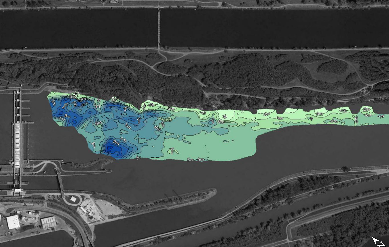
Study area a contour map, generated using a sonar combined with an Active Imaging 3-in-1 transducer device, showing the water depth in the research area downstream of the HPP.
File history
Click on a date/time to view the file as it appeared at that time.
| Date/Time | Thumbnail | Dimensions | User | Comment | |
|---|---|---|---|---|---|
| current | 11:57, 21 October 2020 | | 1,351 × 860 (1.24 MB) | LB (talk | contribs) |
- You cannot overwrite this file.
File usage
The following page uses this file: