File:Eel track.png
Jump to navigation
Jump to search
No higher resolution available.
Eel_track.png (640 × 367 pixels, file size: 300 KB, MIME type: image/png)
| Description |
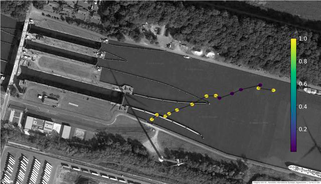
2-D track of a downstream migrating tagged eel passing the sluice complex at Kwaadmechelen (Ham, Belgium) via the side-channel and hydropower installation (HPP not in the picture). Colours indicate the precision of each detected and calculated fish position (dots) on a scale of 1 (minimally 5 m precise) to 0 (maximally 5 m precise) |
| Author | |
| Source |
Vergeynst J (2020) Downstream eel and salmon migration through a shipping canal : challenges on the road. Ghent University (UGhent) and Research Institute for Nature and Forets (INBO) |
File history
Click on a date/time to view the file as it appeared at that time.
| Date/Time | Thumbnail | Dimensions | User | Comment | |
|---|---|---|---|---|---|
| current | 11:07, 18 June 2020 | | 640 × 367 (300 KB) | Bendikhansen (talk | contribs) |
- You cannot overwrite this file.
File usage
The following page uses this file: