File:Piv airborne.png
Original file (1,001 × 590 pixels, file size: 305 KB, MIME type: image/png)
| Description |
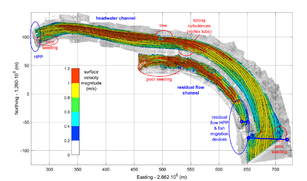
Swiss grid georeferenced surface velocity field and streamlines measured by AIV, including areas of noisy velocity data. (Note that according to Le Coz et al. (2010), depth averaged velocities can be estimated by multiplying the surface velocity by factors 0.79-0.89, with a central value close to 0.85) |
| Author |
Detert et al. 2019 |
| Source |
Detert, M., Cao, L. & Albayrak, I. (2019). Airborne image velocimetry measurements at the hydropower plant Schiffmühle on Limmat river, Switzerland. HydroSenSoft, International Symposium and *Exhibition on Hydro-Environment Sensors and Software, Madrid, Spain, ISBN: 978-90-824846-4-9 |
File history
Click on a date/time to view the file as it appeared at that time.
| Date/Time | Thumbnail | Dimensions | User | Comment | |
|---|---|---|---|---|---|
| current | 09:23, 19 June 2019 | | 1,001 × 590 (305 KB) | Bendikhansen (talk | contribs) |
- You cannot overwrite this file.
File usage
The following page uses this file: