File:Sediment bypass locations square.png
Revision as of 10:46, 17 October 2019 by Bendikhansen (talk | contribs)
No higher resolution available.
Sediment_bypass_locations_square.png (532 × 532 pixels, file size: 94 KB, MIME type: image/png)
| Description |
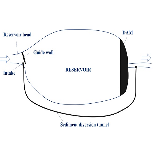
Sediment pass-by tunnel with two different locations of the intake: a) intake located at the reservoir head, b) intake located inside the reservoir. |
| Author | |
| Source |
Cropped from Hauer et al. 2018. State of the art, shortcomings and future challenges for a sustainable sediment management in hydropower: A review. Renewable and Sustainable Energy Reviews 2018(98):40-55. DOI: 10.1016/j.rser.2018.08.031 |
File history
Click on a date/time to view the file as it appeared at that time.
| Date/Time | Thumbnail | Dimensions | User | Comment | |
|---|---|---|---|---|---|
| current | 11:42, 22 June 2019 | | 532 × 532 (94 KB) | Bendikhansen (talk | contribs) |
- You cannot overwrite this file.
File usage
The following page uses this file: