File:Sfm drone picture.png
Revision as of 07:37, 30 September 2020 by Kordula NTNU (talk | contribs)

Size of this preview: 800 × 450 pixels. Other resolutions: 320 × 180 pixels | 1,385 × 779 pixels.
Original file (1,385 × 779 pixels, file size: 2.23 MB, MIME type: image/png)
| Description |
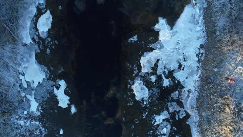
Drone picture taken in a height of 50 m over ground showing the residual flow area in Anundsjø HPP, ice cover and the drone controller |
| Author |
Kordula Schwarzwälder, NTNU |
| Source |
Kordula Schwarzwälder, NTNU |
File history
Click on a date/time to view the file as it appeared at that time.
| Date/Time | Thumbnail | Dimensions | User | Comment | |
|---|---|---|---|---|---|
| current | 10:25, 19 June 2019 | | 1,385 × 779 (2.23 MB) | Bendikhansen (talk | contribs) |
- You cannot overwrite this file.
File usage
The following page uses this file: